Project:Maps
1761?
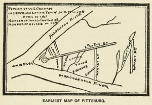
W. Clapham. Report of W. Clapham of Upper and Lower Town of Pittsburg: April 14 1761. 1761. Reproduced in William G. Johnston, Life and Reminiscences from Birth to Manhood of Wm. G. Johnston, p. 21, Knickerbocker Press, New York, 1901 (Google Books N-QEAAAAYAAJ; Historic Pittsburgh 00adj9508m; Internet Archive lifereminiscence00john). [view source] clapham This is of questionable authenticity. It may be a sketch drawn at a later date.
1764

John Campbell. Plan of Lots in Pittsburgh—1764. 1764. Reproduced in William G. Johnston, Life and Reminiscences from Birth to Manhood of Wm. G. Johnston, Knickerbocker Press, New York, 1901 (Google Books N-QEAAAAYAAJ; Historic Pittsburgh 00adj9508m; Internet Archive lifereminiscence00john); in George T. Fleming, "Flem's" Views of Old Pittsburgh: A Portfolio of the Past Precious with Memories, p. 5, Geo. T. Fleming, Pittsburgh, 1905 (HathiTrust 011204797, 100770599; Historic Pittsburgh 31735056290277; Internet Archive flemsviewsofoldp00flem; LCCN 08028848); in George T. Fleming, "History told in Pittsburgh street names: Some commemorative designations have been lost, but others are still in use to recall the story of their selection: Haphazard municipal nomenclature," Pittsburgh Gazette Times, Nov. 29, 1914, sec. 5, p. 2 (Newspapers.com 85906737); in George T. Fleming, "Vickroy tells of surveying new city: Laying out of Market, Liberty and other arteries in Pittsburgh detailed: Much speculation," Pittsburgh Gazette Times, Apr. 1, 1917, sec. 5, p. 2 (Newspapers.com 85873662); in George T. Fleming, "History from an old map: Masson's map of Pittsburgh, 1805, further considered—Campbell's plan of 1764, Woods and Vickroy's complete plan of 1784—the old military plan unwillingly retained—Vickroy's deposition quoted: Pioneer names enumerated as lot owners; Historic characters recalled by names on Masson's plan—explanation of numbering of lots and some mention of freeholders—Imlay's topographical description of 1793," Pittsburgh Gazette Times, July 16, 1922, sec. 2, p. 2 (Newspapers.com 85913850); in George T. Fleming, Fleming's Views of Old Pittsburgh: A Portfolio of the Past, p. 10, Crescent Press, Pittsburgh, 1932; in George Swetnam, "Ferry Street historic, one of oldest in city: Backward switch gives recognition to man undeserving of honor," Pittsburgh Press, Nov. 25, 1954, p. 16 (Newspapers.com 149015965); in Bruce J. Buvinger, The Origin, Development and Persistence of Street Patterns in Pittsburgh, Pennsylvania, p. 21; and in Bob Regan, The Names of Pittsburgh: How the City, Neighborhoods, Streets, Parks and More Got Their Names, p. 57, The Local History Company, Pittsburgh, 2009, ISBN 978-0-9770429-7-5. This map is often called the "military plan of Pittsburgh." [view source] campbell
1769 –
Pennsylvania Department of Internal Affairs. Warrantee Atlas of Allegheny County, Pennsylvania: Constructed from the records on file in the Department of Internal Affairs, and surveys made on the ground during 1909, 1910, 1912 under the direction of Henry Houck. 1914. https://historicpittsburgh.org/collection/warrantee-atlas-allegheny-county-pennsylvania. [view source] warrantee
1784
George Woods. A Draught of the Town Plat of Pittsburgh, Surveyed for John Penn, Jr., and John Penn, by George Woods, May 31st 1784. 1784. Reproduced as "Original plan of Pittsburgh" in plate 19 of Atlas of the Cities of Pittsburgh, Allegheny, and the Adjoining Boroughs, G. M. Hopkins & Co., Philadelphia, 1872 (Historic Pittsburgh 1872p019). [view source] woods-plat
George Woods. A General Draught of the Farms and Out Lots in the Manor of Pittsburgh, Situate Between the Alleghany and Monongahela Rivers, Laid Out by Order of Tench, Fransis, Esqr. Attorney for John Penn, Jr, and John Penn. 1784. Reproduced in plate 17 of Atlas of the Cities of Pittsburgh, Allegheny, and the Adjoining Boroughs, G. M. Hopkins & Co., Philadelphia, 1872 (Historic Pittsburgh 1872p017). [view source] woods-farms
1787

John Hills. Plan of the Lots Laid Out at Pittsburg and the Coal Hill. Philadelphia, 1787. Historic Pittsburgh DARMAP0464; LCCN 74692580. Reproduced in John W. Reps, The Making of Urban America: A History of City Planning in the United States, p. 205, Princeton University Press, Princeton, N. J., 1965 (LCCN 63023414); in Stefan Lorant, Pittsburgh: The Story of an American City, 5th (Millennium) ed., p. 53, Esselmont Books, Pittsburgh, 1999, ISBN 0-967-41030-4 (LCCN 99-066641); and in Emily M. Weaver, The Fort Pitt Block House, p. 40, History Press, Charleston, S. C., 2013, ISBN 978-1-60949-933-4. [view source] hills
1788

Reserve Tract of Land Opposite Pittsburgh. L. J. Richards & Co., 1863. Historic Pittsburgh DARMAP0084. Reproduced in Dan Rooney and Carol Peterson, Allegheny City: A History of Pittsburgh's North Side, pp. 2–3, University of Pittsburgh Press, Pittsburgh, 2013, ISBN 978-0-8229-4422-5 (LCCN 2012047727). A variation entitled City of Allegheny 100 Years Ago is reproduced in Walter C. Kidney and Arthur P. Ziegler, Jr., Allegheny, p. 2, Pittsburgh History & Landmarks Foundation, 1975 (LCCN 75-43276), and in Allegheny City Society, Allegheny City, 1840–1907, pp. 10–11, Images of America, Arcadia Publishing, Charleston, S. C., 2007, ISBN 978-0-7385-5500-3 (LCCN 2007927944). [view source] reserve-tract
1795

George H. Thurston. Fort Pitt in 1795. 1856. In George H. Thurston, Directory for 1856–'57, of Pittsburgh and Allegheny Cities, Birmingham, East Birmingham, South & West Pittsburgh, Temperanceville, Manchester, Duquesne and Lawrenceville Boroughs, East Liberty, and Parts of Pitt and Collins Townships, George H. Thurston, Pittsburgh, 1856, preceding p. iii (Google Books HwYuAAAAYAAJ; HathiTrust 011562263; Historic Pittsburgh 31735038289074). Reproduced in George T. Fleming, "History recalled by street names: Stanwix brings to mind many important happenings in the early days of the Western Pennsylvania settlement," Pittsburgh Gazette Times, Dec. 6, 1914, sec. 2, p. 8 (Newspapers.com 85907599), and with small variations in Annie Clark Miller, Early Land Marks and Names of Old Pittsburgh: An Address Delivered Before the Pittsburgh Chapter Daughters of the American Revolution at Carnegie Institute, Nov. 30, 1923, p. 35, Pittsburgh Chapter Daughters of the American Revolution, 1924 (Historic Pittsburgh 00awn8211m; Internet Archive earlylandmarksna00mill). For additional copies with small variations, lacking clear publication information, see Historic Pittsburgh DARMAP0201, DARMAP0202. [view source] fort-pitt-1795

Pittsburgh 1795. 1869. In History of Allegheny Co., Pennsylvania: With Illustrations Descriptive of its Scenery, Palatial Residences, Public Buildings, Fine Blocks and Important Manufactories, from Original Sketches by Artists of the Highest Ability, plate IV, following p. 58, L. H. Everts & Co., Philadelphia, 1876 (Historic Pittsburgh 00aee8639m). Historic Pittsburgh DARMAP0203. Reproduced in History of Allegheny County, Pennsylvania: Including Its Early Settlement and Progress to the Present Time; a Description of Its Historic and Interesting Localities; Its Cities, Towns and Villages; Religious, Educational, Social and Military History; Mining, Manufacturing and Commercial Interests; Improvements, Resources, Statistics, Etc.: Also Portraits of Some of Its Prominent Men, and Biographies of Many of Its Representative Citizens, p. 484, A. Warner & Co., Chicago, 1889 (Google Books DwzYAAAAMAAJ; Internet Archive historyofalleghe1889cush); in George T. Fleming, Fleming's Views of Old Pittsburgh: A Portfolio of the Past, p. 16, Crescent Press, Pittsburgh, 1932; in Douglas Naylor, "The four corners of Pittsburgh: Old timer of Buttermilk Hollow will 'talk 7 straight hours': Subterranean coal fire will destroy city some day, residents believe," Pittsburgh Press, Apr. 12, 1932, p. 17 (Newspapers.com 146918248); in Bruce J. Buvinger, The Origin, Development and Persistence of Street Patterns in Pittsburgh, Pennsylvania, p. 22; in Stefan Lorant, Pittsburgh: The Story of an American City, 5th (Millennium) ed., pp. 62–63, Esselmont Books, Pittsburgh, 1999, ISBN 0-967-41030-4 (LCCN 99-066641); and in Bob Regan, The Names of Pittsburgh: How the City, Neighborhoods, Streets, Parks and More Got Their Names, p. 57, The Local History Company, Pittsburgh, 2009, ISBN 978-0-9770429-7-5. [view source] pittsburgh-1795
1796

Victor Collot. Plan of the Town of Pittsburg. 1826. In Victor Collot, A Journey in North America: Containing a Survey of the Countries Watered by the Mississipi [sic], Ohio, Missouri, and Other Affluing Rivers; with Exact Observations on the Course and Soundings of These Rivers; and on the Towns, Villages, Hamlets and Farms of That Part of the New-World; Followed by Philosophical, Political, Military and Commercial Remarks and by a Projected Line of Frontiers and General Limits: Illustrated by 36 Maps, Plans, Views and Divers Cuts, vol. 2 (atlas), plate 6, Arthur Bertrand, Paris, 1826 (Historic Pittsburgh 31735061295659). http://www.davidrumsey.com/maps5639.html; 1796 layer at Pittsburgh Historic Maps (https://esriurl.com/pittsburgh). Reproduced in Stefan Lorant, Pittsburgh: The Story of an American City, 5th (Millennium) ed., p. 93, Esselmont Books, Pittsburgh, 1999, ISBN 0-967-41030-4 (LCCN 99-066641). [view source] collot
1805
William Masson. Plan of Pittsburgh: With the Allegany and Monongohaley Rivers: Shewing there connection into the ohio: Likewise the different vessels built at Pittsburgh: Octor 10th, 1805. 1805. Reproduced in George T. Fleming, "Early annals of the port of Pittsburgh: In the days of shipbuilding—curious old map evokes much history—Pittsburgh in 1805 revealed—Stephen Quinon's story of our ocean commerce—the little square riggers that sailed from Pittsburgh: Some pages from the book of a French savant: Pittsburgh as F. A. Michaux saw it in 1802: Our river commerce of that time—his story of our sailing and other vessels—his meeting with the Chevalier Dubac," Pittsburgh Gazette Times, July 2, 1922, sec. 5, p. 2 (Newspapers.com 85856279); in George T. Fleming, "History from an old map: William Masson's map of Pittsburgh in 1805 studied and explained—seagoing vessels outlined and old-time residences marked; the vacant tracts outside borough lines noted—a rugged topography indicated; the many ferries of the period," Pittsburgh Gazette Times, July 9, 1922, sec. 5, p. 2 (Newspapers.com 85913400); in Charles Henry Ambler, A History of Transportation in the Ohio Valley: With Special Reference to Its Waterways, Trade, and Commerce from the Earliest Period to the Present Time, p. 95, Arthur H. Clark Co., Glendale, Calif., 1932 (HathiTrust 001108773); in Stefan Lorant, Pittsburgh: The Story of an American City, 5th (Millennium) ed., p. 75, Esselmont Books, Pittsburgh, 1999, ISBN 0-967-41030-4 (LCCN 99-066641); and in David Halaas and Andrew Masich, "Rediscovering Lewis & Clark," Western Pennsylvania History, vol. 86, no. 4, winter 2003–04, pp. 12–21 (https://journals.psu.edu/wph/article/view/7563). [view source] masson
1815

Wm. Darby. Plan of Pittsburg and Adjacent Country. R. Patterson and W. Darby, Philadelphia, 1815. Historic Pittsburgh DARMAP0197, DARMAP0198. Reproduced in John W. Reps, The Making of Urban America: A History of City Planning in the United States, p. 207, Princeton University Press, Princeton, N. J., 1965 (LCCN 63023414); and in Bruce J. Buvinger, The Origin, Development and Persistence of Street Patterns in Pittsburgh, Pennsylvania, p. 24. Also reproduced as "Plan von Pittsburg und Umgebungen" in Bernhard, Duke of Saxe-Weimar-Eisenach (Heinrich Luden, ed.), Reise Sr. Hoheit des Herzogs Bernhard zu Sachsen-Weimar-Eisenach durch Nord-Amerika in den Jahren 1825 und 1826, vol. II, following p. 200, Wilhelm Hoffmann, Weimar, 1828 (Internet Archive reisesrhoheitdes00bern, reisesrhoheitdes00inbern). [view source] darby
1817
David Dougal and Jno. E. Whiteside. The Map of Allegheny County. 1817. https://www.phmc.state.pa.us/bah/dam/rg/di/r17-534WhitesideMaps/r017_0534_0000_3343_AlleghenyCounty.pdf. Linked from https://sites.psu.edu/mapsgislib/pennsylvania-early-county-maps-and-altases/. [view source] dougal
1830

Jean Barbeau and Lewis Keyon. Map of Pittsburgh and Its Environs. N. B. Molineux, Pittsburgh, 1830. Historic Pittsburgh DARMAP0576; https://digitalcollections.nypl.org/items/36c3ab00-57aa-0136-8f4f-08990f217bc9. [view source] barbeau
1835

Lewis Keyon. Map of Pittsburgh and Its Environs. Johnston & Stockton, Pittsburgh, 1835. Historic Pittsburgh DARMAP0577; 1835 layer at Pittsburgh Historic Maps (https://esriurl.com/pittsburgh). [view source] keyon
1845
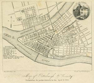
R. E. M'Gowan. Map of Pittsburgh & Vicinity: Designating the portion destroyed by fire, April 10, 1845. J. W. Cook, Pittsburgh, 1845. https://commons.wikimedia.org/wiki/File:Pittsburgh_map_1845.jpg. Published in the front matter of J. Heron Foster, A Full Account of the Great Fire at Pittsburgh, on the Tenth Day of April, 1845: With the Individual Losses, and Contributions for Relief, J. W. Cook, Pittsburgh, 1845 (Internet Archive fullaccountofgre00fost) and of O. Ormsby Gregg, Isaac Gregg, and Moses F. Eaton, Pittsburgh, Her Advantageous Position and Great Resources, as a Manufacturing and Commercial City, Embraced in a Notice of Sale of Real Estate, Johnson & Stockton, Pittsburgh, 1845 (Google Books nrJs-DDEN1sC; Historic Pittsburgh 00afu7810m). [view source] mcgowin-1845
1850

E. H. Heastings. Map of the County of Allegheny, Pennsylvania. 1850. Historic Pittsburgh DARMAP0090. [view source] heastings
1851

Sidney & Neff and S. McRea. Map of Allegheny County, Pennsylvania, with the Names of Property-Holders. Philadelphia, 1851. LCCN 2012592150. [view source] sidney-neff
1852
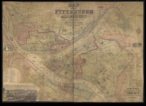
R. E. McGowin. Map of the Cities of Pittsburgh and Allegheny and of the Boroughs of South-Pittsburgh, Birmingham, East-Birmingham, Lawrenceville, Duquesne & Manchester etc. Schuchman & Haunlein, Pittsburgh, 1852. https://collections.lib.uwm.edu/digital/collection/agdm/id/32269. [view source] mcgowin-1852
1855

The Cities of Pittsburgh and Allegheny, with Parts of Adjacent Boroughs, Pennsylvania. 1855. Historic Pittsburgh DARMAP0089; https://www.davidrumsey.com/luna/servlet/detail/RUMSEY~8~1~1688~130047; https://collections.lib.uwm.edu/digital/collection/agdm/id/32240; 1855 layer at Pittsburgh Historic Maps (https://esriurl.com/pittsburgh). In George W. Colton, Colton's Atlas of the World: Illustrating physical and political geography, J. H. Colton & Co., New York, 1856 (https://www.davidrumsey.com/luna/servlet/view/search?q=Pub_List_No%3D0149.000). [view source] colton
1856

R. E. McGowin. Pittsburgh: Engraved from R. E. McGowin's map for Geo. H. Thurston. Wm. Schuchman & Bro., Pittsburgh, 1856. Historic Pittsburgh DARMAP0091. [view source] mcgowin-1856
1862

S. N. & F. W. Beers. Map of Allegheny Co., Pennsylvania. Smith, Gallup & Hewitt, Philadelphia, 1862. LCCN 2012592151; https://collections.lib.uwm.edu/digital/collection/agdm/id/31783; 1862 layer at Pittsburgh Historic Maps (https://esriurl.com/pittsburgh). [view source] beers
1867

Map of Pittsburgh and Environs: Published for the monthly magazine entitled The Iron City, a compendium of facts concerning Pittsburgh and vicinity. 1867. In The Iron City: A compendium of facts concerning Pittsburgh and vicinity, for strangers and the public generally, George W. Pittock and Kinsey McFall, Pittsburgh, 1867, following p. 132 (Internet Archive ironcitycompendi01pitt). [view source] iron-city-map

Woods' New Map of Pittsburgh, Allegheny and Surroundings: 1867. A. Hani, Pittsburgh, 1867. https://digitalcollections.nypl.org/items/a9c4def0-d462-0135-7cac-417576d76635; https://www.mapsofpa.com/pitts/1867-8530.jpg. [view source] woods-1867
1872
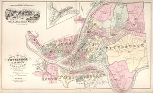
Atlas of the Cities of Pittsburgh, Allegheny, and the Adjoining Boroughs. G. M. Hopkins & Co., Philadelphia, 1872. http://historicpittsburgh.org/maps-hopkins/1872-atlas-pittsburgh-allegheny; 1872 layer at Pittsburgh Historic Maps (https://esriurl.com/pittsburgh). [view source] hopkins-1872
1876
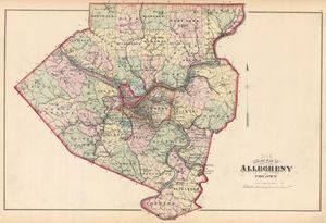
Atlas of the Cities of Pittsburgh, Allegheny, and the Adjoining Boroughs. G. M. Hopkins & Co., Philadelphia, 1876. http://historicpittsburgh.org/maps-hopkins/1876-atlas-pittsburgh-allegheny; included in the 1872 layer at Pittsburgh Historic Maps (https://esriurl.com/pittsburgh). [view source] hopkins-1876
1882
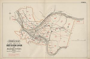
Atlas of the Cities Pittsburgh and Allegheny. G. M. Hopkins & Co., Philadelphia, 1882. http://historicpittsburgh.org/maps-hopkins/1882-atlas-pittsburgh-allegheny; 1882 layer at Pittsburgh Historic Maps (https://esriurl.com/pittsburgh). [view source] hopkins-1882
1883
Alex. Y. Lee. Map of Allegheny County, Pennsylvania. Otto Krebs, Pittsburgh, 1883. LCCN 2012592152. [view source] lee
1884
Insurance Maps of Pittsburgh, Pennsylvania, vol. 1. Sanborn Map Publishing Co., New York, 1884. https://www.loc.gov/item/sanborn07911_001/. [view source] sanborn-1884-vol-1
Pittsburgh, Pennsylvania, vol. 2. Sanborn Map Publishing Co., New York, 1884. https://www.loc.gov/item/sanborn07911_002/. [view source] sanborn-1884-vol-2
1886
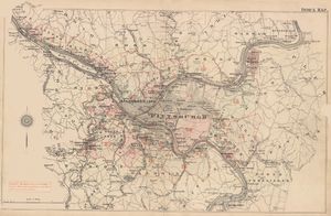
Atlas of the Vicinity of the Cities Pittsburgh and Allegheny, Pennsylvania. G. M. Hopkins & Co., Philadelphia, 1886. http://historicpittsburgh.org/maps-hopkins/1886-atlas-pittsburgh-allegheny; included in the 1882 layer at Pittsburgh Historic Maps (https://esriurl.com/pittsburgh). [view source] hopkins-1886
Driving Map of Allegheny County, Pennsylvania. G. M. Hopkins, C. E., Philadelphia, 1886. Historic Pittsburgh DARMAP0829A, DARMAP0829B. [view source] hopkins-1886-driving
1889
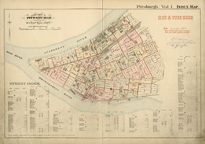
Atlas of the City of Pittsburgh, vol. 1. G. M. Hopkins & Co., Philadelphia, 1889. http://historicpittsburgh.org/maps-hopkins/1889-volume-1-atlas-pittsburgh; included in the 1890 layer at Pittsburgh Historic Maps (https://esriurl.com/pittsburgh). [view source] hopkins-1889-vol-1
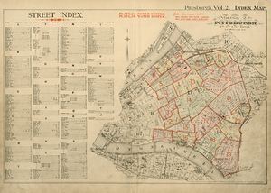
Atlas of the City of Pittsburgh, vol. 2. G. M. Hopkins & Co., Philadelphia, 1889. http://historicpittsburgh.org/maps-hopkins/1889-volume-2-atlas-pittsburgh; included in the 1890 layer at Pittsburgh Historic Maps (https://esriurl.com/pittsburgh). [view source] hopkins-1889-vol-2
1890
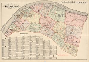
Atlas of the City of Pittsburgh, vol. 3. G. M. Hopkins & Co., Philadelphia, 1890. http://historicpittsburgh.org/maps-hopkins/1890-volume-3-atlas-pittsburgh; included in the 1890 layer at Pittsburgh Historic Maps (https://esriurl.com/pittsburgh). [view source] hopkins-1890-vol-3
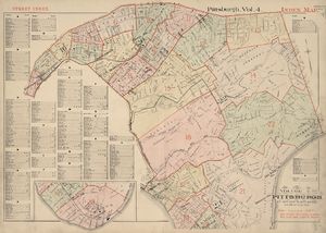
Atlas of the City of Pittsburgh, vol. 4. G. M. Hopkins & Co., Philadelphia, 1890. http://historicpittsburgh.org/maps-hopkins/1890-volume-4-atlas-pittsburgh; included in the 1890 layer at Pittsburgh Historic Maps (https://esriurl.com/pittsburgh). [view source] hopkins-1890-vol-4
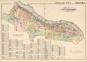
Atlas of the City of Pittsburgh, vol. 5. G. M. Hopkins & Co., Philadelphia, 1890. http://historicpittsburgh.org/maps-hopkins/1890-volume-5-atlas-pittsburgh; included in the 1890 layer at Pittsburgh Historic Maps (https://esriurl.com/pittsburgh). [view source] hopkins-1890-vol-5
Map of Allegheny County, Pennsylvania: With adjoining parts of Westmoreland, Washington & Beaver Counties. Otto Krebs, Pittsburgh, 1890. LCCN 2012592153. [view source] krebs
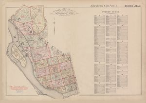
Real Estate Plat-Book of the City of Allegheny, vol. 1. G. M. Hopkins & Co., Philadelphia, 1890. http://historicpittsburgh.org/maps-hopkins/1890-volume-1-plat-book-allegheny; included in the 1890 layer at Pittsburgh Historic Maps (https://esriurl.com/pittsburgh). [view source] hopkins-1890-allegheny-vol-1
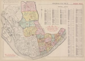
Real Estate Plat-Book of the City of Allegheny, vol. 2. G. M. Hopkins & Co., Philadelphia, 1890. http://historicpittsburgh.org/maps-hopkins/1890-volume-2-plat-book-allegheny; included in the 1890 layer at Pittsburgh Historic Maps (https://esriurl.com/pittsburgh). [view source] hopkins-1890-allegheny-vol-2
1893
Insurance Maps of Pittsburg, Pennsylvania, vol. 1. Sanborn-Perris Map Co., New York, 1893. https://www.loc.gov/item/sanborn07911_003. [view source] sanborn-1893-vol-1
Insurance Maps of Pittsburg, Pennsylvania, vol. 2. Sanborn-Perris Map Co., New York, 1893. https://www.loc.gov/item/sanborn07911_004/. [view source] sanborn-1893-vol-2
Insurance Maps of Pittsburg, Pennsylvania, vol. 3. Sanborn-Perris Map Co., New York, 1893. https://www.loc.gov/item/sanborn07911_005/. [view source] sanborn-1893-vol-3
1895

J. F. Diffenbacher. Map of Pittsburgh and Allegheny Cities. 1895. In J. F. Diffenbacher, J. F. Diffenbacher's Directory of Pittsburg and Allegheny Cities for 1895: Embracing a general directory of residences of citizens, full classified business directory, register of public institutions, benevolent societies and city government; directory of the streets, secret societies, schools and churches, fortieth annual issue, J. F. Diffenbacher, Pittsburgh, 1895 (DonsList.net Pgh1895M; Google Books 8ptIwuAxp1wC; HathiTrust mdp.39015068427627; Historic Pittsburgh 31735055723278). [view source] diffenbacher-1895-map

J. M. Kelly. Map of Pittsburg and Allegheny, 1895: Showing parks, boulevards, cemeteries, streets, prominent industries, street railways, steam railroads, bridges, &c., and an outline map of the proposed Greater Pittsburg, issued in connection with and as part of J. M. Kelly's Hand-Book of Greater Pittsburg. J. M. Kelly Co., Pittsburgh, 1895. Historic Pittsburgh DARMAP0465. [view source] kelly
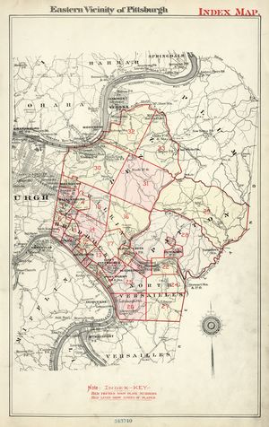
Real Estate Plat-Book of the Eastern Vicinity of Pittsburgh, Penna. G. M. Hopkins & Co., Philadelphia, 1895. http://historicpittsburgh.org/maps-hopkins/1895-plat-book-eastern-Pittsburgh. [view source] hopkins-1895
1896
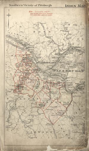
Real Estate Plat-Book of the Southern Vicinity of Pittsburgh, Penna. G. M. Hopkins & Co., Philadelphia, 1896. http://historicpittsburgh.org/maps-hopkins/1896%E2%80%93plat-book-southern-pittsburgh; included in the 1890 layer at Pittsburgh Historic Maps (https://esriurl.com/pittsburgh). [view source] hopkins-1896
1897
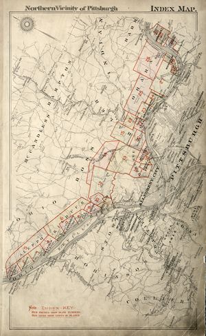
Real Estate Plat-Book of the Northern Vicinity of Pittsburgh. G. M. Hopkins & Co., Philadelphia, 1897. http://historicpittsburgh.org/maps-hopkins/1897-plat-book-northern-pittsburgh. [view source] hopkins-1897
1898
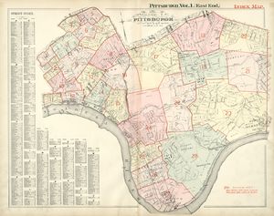
Real Estate Plat-Book of the City of Pittsburgh, vol. 1. G. M. Hopkins & Co., Philadelphia, 1898. http://historicpittsburgh.org/maps-hopkins/1898-volume-1-plat-book-pittsburgh-east. [view source] hopkins-1898-vol-1
1899
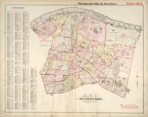
Real Estate Plat-Book of the City of Pittsburgh, vol. 2. G. M. Hopkins & Co., Philadelphia, 1899. http://historicpittsburgh.org/maps-hopkins/1899-volume-2-plat-book-pittsburgh-east. [view source] hopkins-1899-vol-2
1900
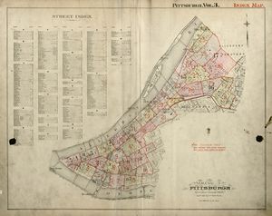
Real Estate Plat-Book of the City of Pittsburgh, vol. 3. G. M. Hopkins & Co., Philadelphia, 1900. http://historicpittsburgh.org/maps-hopkins/1900-volume-3-plat-book-pittsburgh. [view source] hopkins-1900-vol-3
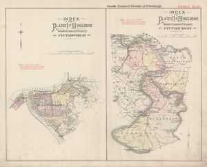
Real Estate Plat-Book of the South-Eastern Vicinity of Pittsburgh, Penna.: From official records, private plans and actual surveys. G. M. Hopkins & Co., Philadelphia, 1900. https://historicpittsburgh.org/maps-hopkins/1900-map-1-plat-book-south-eastern-pittsburgh; https://historicpittsburgh.org/maps-hopkins/1900-map-2-plat-book-south-eastern-pittsburgh. [view source] hopkins-1900-southeast
1901
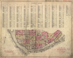
Real Estate Plat-Book of the City of Allegheny, vol. 1. G. M. Hopkins & Co., Philadelphia, 1901. http://historicpittsburgh.org/maps-hopkins/1901-volume-1--plat-book-allegheny. [view source] hopkins-1901-allegheny-vol-1
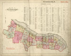
Real Estate Plat-Book of the City of Pittsburgh, vol. 4. G. M. Hopkins & Co., Philadelphia, 1901. http://historicpittsburgh.org/maps-hopkins/1901-volume-4-plat-book-pittsburgh; included in the 1903–1906 layer at Pittsburgh Historic Maps (https://esriurl.com/pittsburgh). [view source] hopkins-1901-vol-4
1902
The Blue Book Map of Pittsburg, Allegheny and Environs for 1902. Élite Publishing Co., Pittsburgh, 1902. Historic Pittsburgh DARMAP0805, DARMAP0806. [view source] blue-book-map
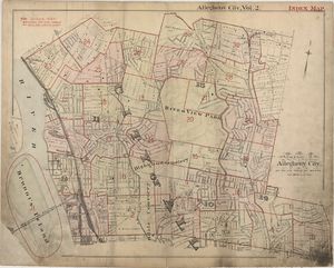
Real Estate Plat-Book of the City of Allegheny, vol. 2. G. M. Hopkins & Co., Philadelphia, 1902. http://historicpittsburgh.org/maps-hopkins/1902-volume-2-plat-book-allegheny; included in the 1903–1906 layer at Pittsburgh Historic Maps (https://esriurl.com/pittsburgh). [view source] hopkins-1902-allegheny-vol-2
1903
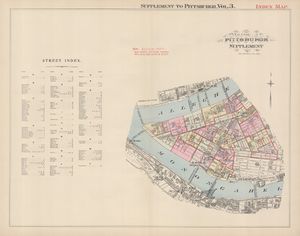
Real Estate Plat-Book of the City of Pittsburgh, supplement to vol. 3. G. M. Hopkins & Co., Philadelphia, 1903. http://historicpittsburgh.org/maps-hopkins/1903-volume-3-supplement-plat-book-pittsburgh-central. [view source] hopkins-1903-vol-3-supp
1904
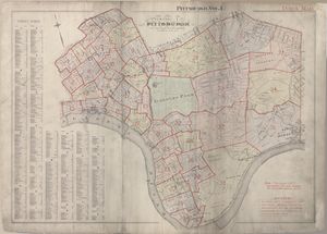
Real Estate Plat-Book of the City of Pittsburgh, vol. 1. G. M. Hopkins & Co., Philadelphia, 1904. http://historicpittsburgh.org/maps-hopkins/1904-volume-1-plat-book-pittsburgh; included in the 1903–1906 layer at Pittsburgh Historic Maps (https://esriurl.com/pittsburgh). [view source] hopkins-1904-vol-1
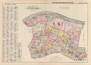
Real Estate Plat-Book of the City of Pittsburgh, vol. 2. G. M. Hopkins & Co., Philadelphia, 1904. http://historicpittsburgh.org/maps-hopkins/1904-volume-2-plat-book-pittsburgh; included in the 1903–1906 layer at Pittsburgh Historic Maps (https://esriurl.com/pittsburgh). [view source] hopkins-1904-vol-2
1905
Wm. McClurg Donley. Carrick Borough: Situated in Allegheny County Pennsylvania. 1905. Hanging on the wall in the Carrick branch of the Carnegie Library of Pittsburgh. [view source] carrick-map-1905
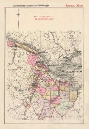
Real Estate Plat-Book of the Southern Vicinity of Pittsburgh. G. M. Hopkins & Co., Philadelphia, 1905. http://historicpittsburgh.org/maps-hopkins/1905-plat-book-southern-pittsburgh; included in the 1903–1906 layer at Pittsburgh Historic Maps (https://esriurl.com/pittsburgh). [view source] hopkins-1905
1906
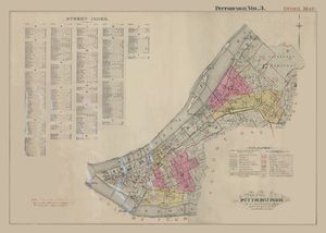
Real Estate Plat-Book of the City of Pittsburgh, vol. 3. G. M. Hopkins & Co., Philadelphia, 1906. http://historicpittsburgh.org/maps-hopkins/1906-volume-3-plat-book-pittsburgh; included in the 1903–1906 layer at Pittsburgh Historic Maps (https://esriurl.com/pittsburgh). [view source] hopkins-1906-vol-3
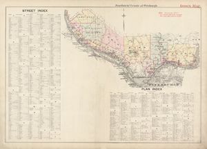
Real Estate Plat-Book of the Northern Vicinity of Pittsburgh. G. M. Hopkins & Co., Philadelphia, 1906. http://historicpittsburgh.org/maps-hopkins/1906-plat-book-northern-pittsburgh. [view source] hopkins-1906
1907
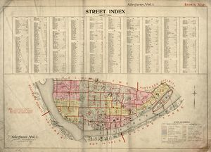
Real Estate Plat-Book of the City of Allegheny, vol. 1. G. M. Hopkins & Co., Philadelphia, 1907. http://historicpittsburgh.org/maps-hopkins/1907-volume-1-plat-book-allegheny; included in the 1903–1906 layer at Pittsburgh Historic Maps (https://esriurl.com/pittsburgh). [view source] hopkins-1907-allegheny-vol-1
1910
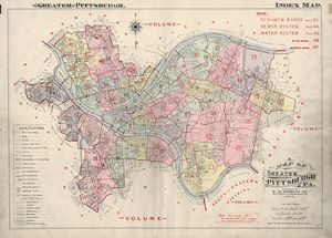
Atlas of Greater Pittsburgh. G. M. Hopkins & Co., Philadelphia, 1910. http://historicpittsburgh.org/maps-hopkins/1910-atlas-greater-pittsburgh; 1910 layer at Pittsburgh Historic Maps (https://esriurl.com/pittsburgh). [view source] hopkins-1910
1911
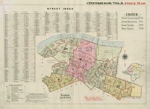
Real Estate Plat-Book of the City of Pittsburgh, vol. 3. G. M. Hopkins & Co., Philadelphia, 1911. http://historicpittsburgh.org/maps-hopkins/1911-volume-3-plat-book-pittsburgh. [view source] hopkins-1911-vol-3
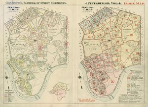
Real Estate Plat-Book of the City of Pittsburgh, vol. 4. G. M. Hopkins & Co., Philadelphia, 1911. http://historicpittsburgh.org/maps-hopkins/1911-volume-4-plat-book-pittsburgh. [view source] hopkins-1911-vol-4
1915
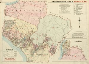
Real Estate Plat-Book of the City of Pittsburgh, vol. 8. G. M. Hopkins & Co., Philadelphia, 1915. http://historicpittsburgh.org/maps-hopkins/1915-volume-8-plat-book-pittsburgh-eastern. [view source] hopkins-1915-vol-8
1923
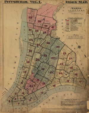
Real Estate Plat-Book of the City of Pittsburgh, vol. 1. G. M. Hopkins & Co., Philadelphia, 1923. http://historicpittsburgh.org/maps-hopkins/1923-volume-1-plat-book-pittsburgh; included in the 1923 layer at Pittsburgh Historic Maps (https://esriurl.com/pittsburgh). [view source] hopkins-1923-vol-1
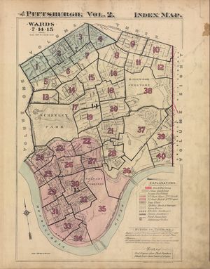
Real Estate Plat-Book of the City of Pittsburgh, vol. 2. G. M. Hopkins & Co., Philadelphia, 1923. http://historicpittsburgh.org/maps-hopkins/1923-volume-2-plat-book-pittsburgh-east-end-south; included in the 1923 layer at Pittsburgh Historic Maps (https://esriurl.com/pittsburgh). [view source] hopkins-1923-vol-2
1924
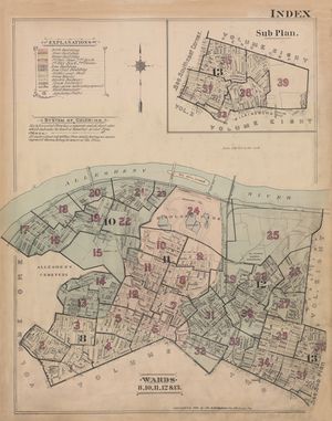
Real Estate Plat-Book of the City of Pittsburgh, vol. 3. G. M. Hopkins & Co., Philadelphia, 1924. http://historicpittsburgh.org/maps-hopkins/1924-volume-3-plat-book-pittsburgh; included in the 1923 layer at Pittsburgh Historic Maps (https://esriurl.com/pittsburgh). [view source] hopkins-1924-vol-3
1925
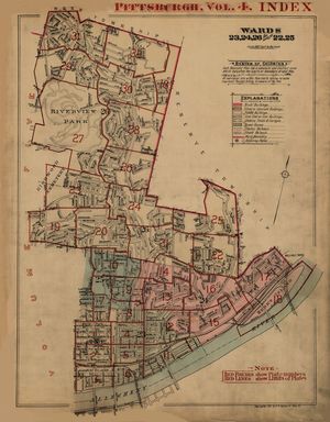
Real Estate Plat-Book of the City of Pittsburgh, vol. 4. G. M. Hopkins & Co., Philadelphia, 1925. http://historicpittsburgh.org/maps-hopkins/1925-volume-4-plat-book-pittsburgh; included in the 1923 layer at Pittsburgh Historic Maps (https://esriurl.com/pittsburgh). [view source] hopkins-1925-vol-4
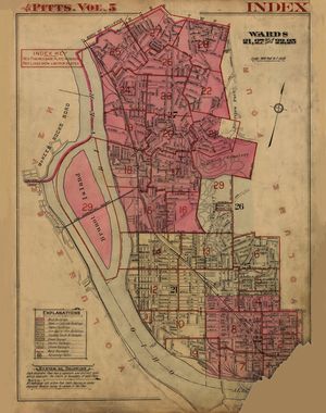
Real Estate Plat-Book of the City of Pittsburgh, vol. 5. G. M. Hopkins & Co., Philadelphia, 1925. http://historicpittsburgh.org/maps-hopkins/1925-volume-5-plat-book-pittsburgh; included in the 1923 layer at Pittsburgh Historic Maps (https://esriurl.com/pittsburgh). [view source] hopkins-1925-vol-5
1928
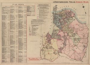
Plat-Book of the City of Pittsburgh, vol. 6. G. M. Hopkins & Co., Philadelphia, 1916, revised 1922 and 1928. http://historicpittsburgh.org/maps-hopkins/1916-volume-6-plat-book-pittsburgh-south-side-southern; included in the 1923 layer at Pittsburgh Historic Maps (https://esriurl.com/pittsburgh). [view source] hopkins-1928-vol-6
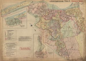
Plat-Book of the City of Pittsburgh, vol. 7. G. M. Hopkins & Co., Philadelphia, 1917, revised 1928. http://historicpittsburgh.org/maps-hopkins/1917-volume-7-plat-book-pittsburgh-south-side-southern; included in the 1923 layer at Pittsburgh Historic Maps (https://esriurl.com/pittsburgh). [view source] hopkins-1928-vol-7
1929
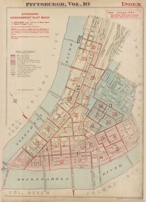
Assessment Plat-Book of the City of Pittsburgh, vol. 10. G. M. Hopkins & Co., Philadelphia, 1929. http://historicpittsburgh.org/maps-hopkins/1929-volume-10-assessment-plat-book-pittsburgh-central. [view source] hopkins-1929-vol-10
1939
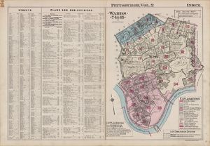
Real Estate Plat-Book of the City of Pittsburgh, vol. 2. G. M. Hopkins & Co., Philadelphia, 1939. http://historicpittsburgh.org/maps-hopkins/1939-volume-2-plat-book-pittsburgh. [view source] hopkins-1939-vol-2
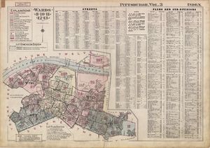
Real Estate Plat-Book of the City of Pittsburgh, vol. 3. G. M. Hopkins & Co., Philadelphia, 1939. http://historicpittsburgh.org/maps-hopkins/1939-volume-3-plat-book-pittsburgh-east-end-north. [view source] hopkins-1939-vol-3
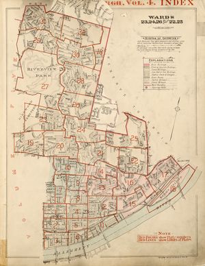
Real Estate Plat-Book of the City of Pittsburgh, vol. 4. G. M. Hopkins & Co., Philadelphia, 1925, revised 1939. https://historicpittsburgh.org/maps-hopkins/1925-volume-4-revised-1939-plat-book-pittsburgh. [view source] hopkins-1939-vol-4
1940
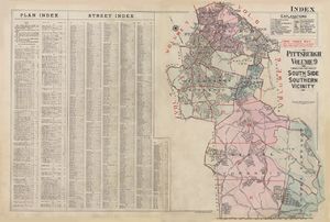
Plat-Book of the City of Pittsburgh, vol. 9. G. M. Hopkins & Co., Philadelphia, 1934, revised 1940. http://historicpittsburgh.org/maps-hopkins/1934-volume-9-plat-book-pittsburgh-south-side-southern. [view source] hopkins-1934-vol-9
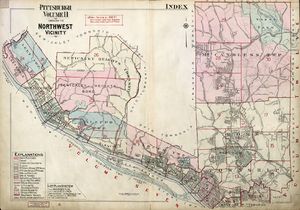
Plat-Book of the Northwestern Vicinity of Pittsburgh, vol. 11. G. M. Hopkins & Co., Philadelphia, 1940. http://historicpittsburgh.org/maps-hopkins/1940-volume-11-plat-book-northwestern-pittsburgh. [view source] hopkins-1940-vol-11
1953
Alexander Gross. Pittsburgh and Vicinity: Featuring transit lines and house numbers. Geographia Map Co. Inc., New York, 1953. Published with Alexander Gross, The Complete Street Guide to Pittsburgh and 16 Nearby Suburbs: With large map of Pittsburgh and suburbs; streets, house numbers, transportation lines, places of interest, churches, etc., etc., Geographia Map Co. Inc., New York, 1953 (DonsList.net PghStreets1953M). A slightly different version entitled The Premier Map of Pittsburgh and Vicinity is reproduced in Sam Stephenson, ed., Dream Street: W. Eugene Smith's Pittsburgh Project, pp. 22–23, University of Chicago Press, Chicago and London, 2023, ISBN 978-0-226-82483-3 (LCCN 2022055151). [view source] gross-map
Present day
Pittsburgh Map. Pittsburgh Department of City Planning, GIS Division. https://pittsburghpa.maps.arcgis.com/apps/instant/basic/index.html?appid=0b82e78539464c3da121dcab22e444d4. Linked from https://www.pittsburghpa.gov/Business-Development/Geographic-Information-System-GIS/Interactive-Maps. [view source] pgh-city-planning-map
Pittsburgh Neighborhoods. Pittsburgh Department of City Planning, GIS Division. https://pittsburghpa.maps.arcgis.com/apps/instant/basic/index.html?appid=ba190d8a0d80444f899db1cf93220ec4. Linked from https://www.pittsburghpa.gov/Business-Development/Geographic-Information-System-GIS/Interactive-Maps. [view source] pgh-nbhds-map


