File:Foerster plan of lots.tiff
From Pittsburgh Streets

Size of this JPG preview of this TIF file: 548 × 600 pixels. Other resolution: 1,871 × 2,048 pixels.
Original file (3,584 × 3,923 pixels, file size: 43 KB, MIME type: image/tiff)
Summary
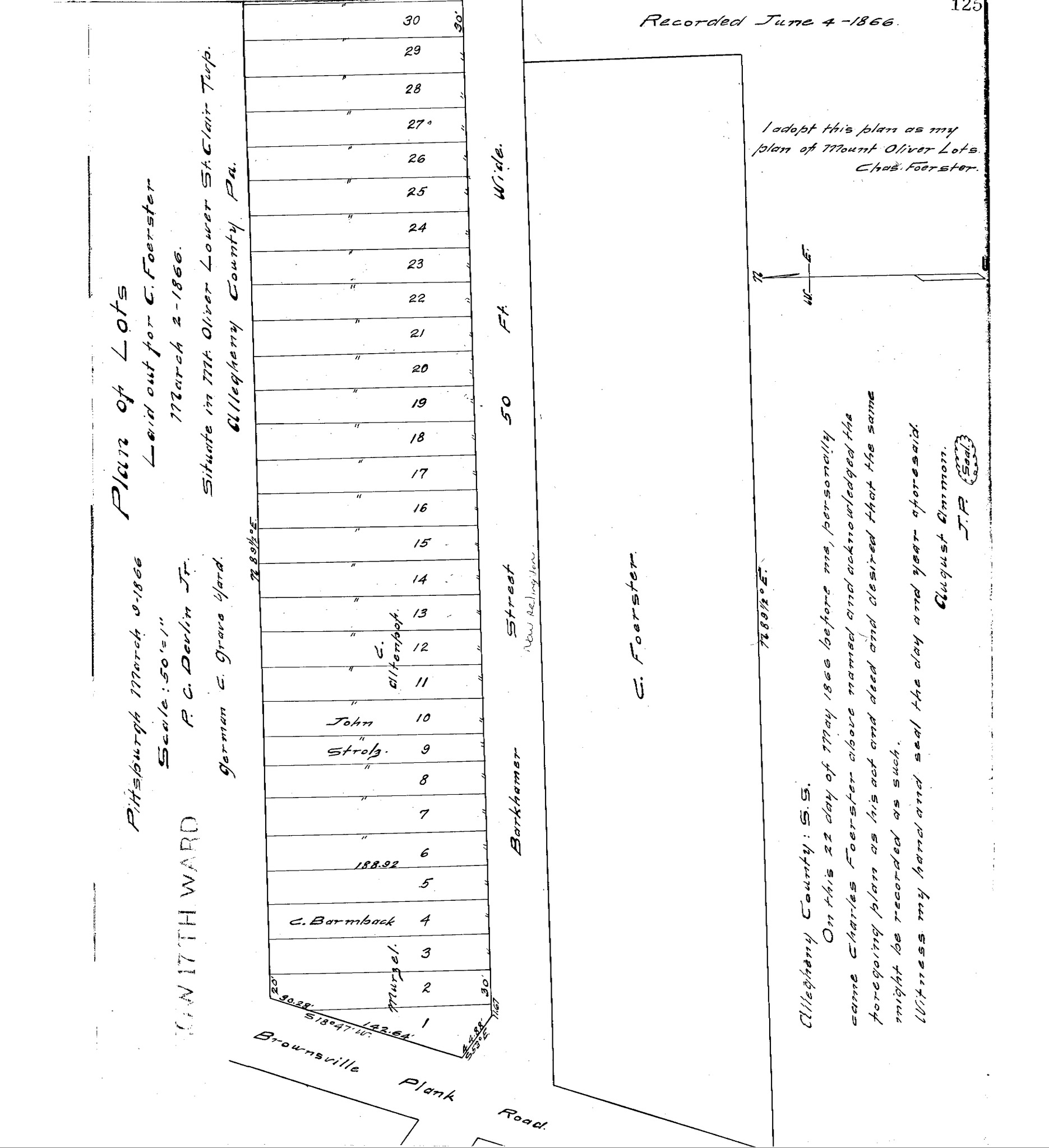
"Plan of lots laid out for C. Foerster, March 2, 1866, situate in Mt. Oliver, Lower St. Clair Twp., Allegheny County, Pa." Laid out Mar. 2, 1866; recorded June 4, 1866, Plan Book 3, p. 125. Allegheny County Recorder of Deeds 3778552. [view source] foerster-plan
File history
Click on a date/time to view the file as it appeared at that time.
| Date/Time | Thumbnail | Dimensions | User | Comment | |
|---|---|---|---|---|---|
| current | 03:30, 15 May 2023 |  | 3,584 × 3,923 (43 KB) | Bkell (talk | contribs) | {{Source:Foerster-plan}} |
You cannot overwrite this file.
File usage
The following 2 pages use this file: