File:Chicken Alley, 1889.jpg
From Pittsburgh Streets
Size of this preview: 800 × 489 pixels. Other resolutions: 2,560 × 1,565 pixels | 3,750 × 2,292 pixels.
Original file (3,750 × 2,292 pixels, file size: 1.88 MB, MIME type: image/jpeg)
Summary
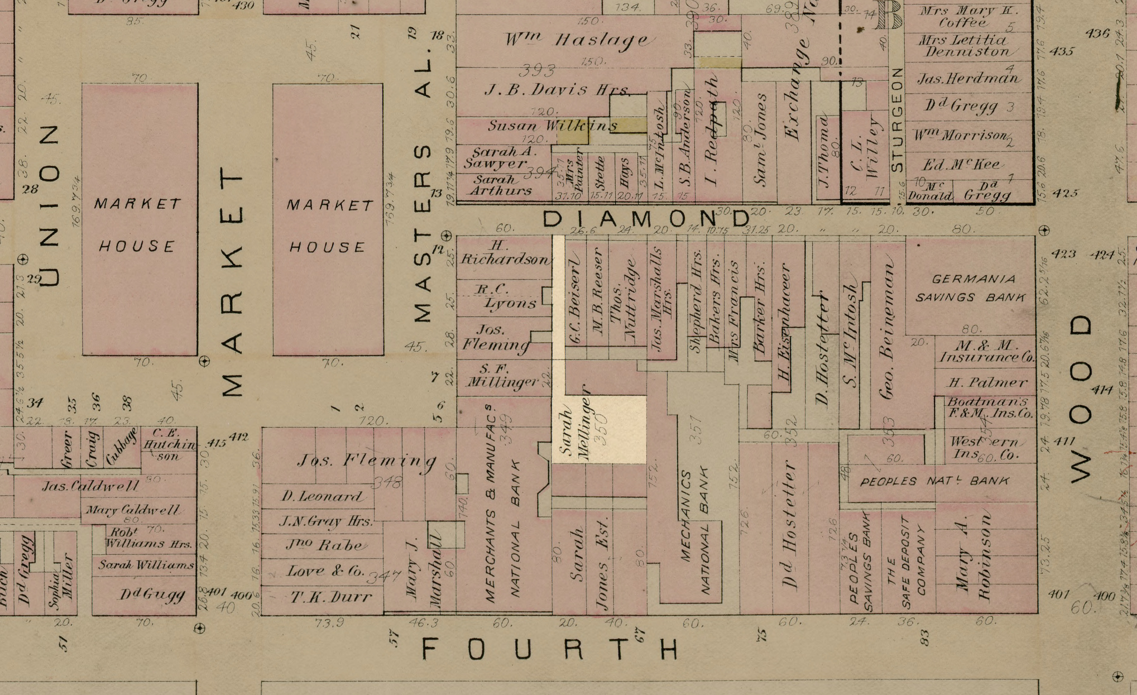
Chicken Alley highlighted in the 1889 Hopkins atlas.[1]
References
- ↑ Atlas of the City of Pittsburgh, vol. 1, plate 4. G. M. Hopkins & Co., Philadelphia, 1889. http://historicpittsburgh.org/maps-hopkins/1889-volume-1-atlas-pittsburgh; included in the 1890 layer at Pittsburgh Historic Maps (https://esriurl.com/pittsburgh). [view source] hopkins-1889-vol-1
File history
Click on a date/time to view the file as it appeared at that time.
| Date/Time | Thumbnail | Dimensions | User | Comment | |
|---|---|---|---|---|---|
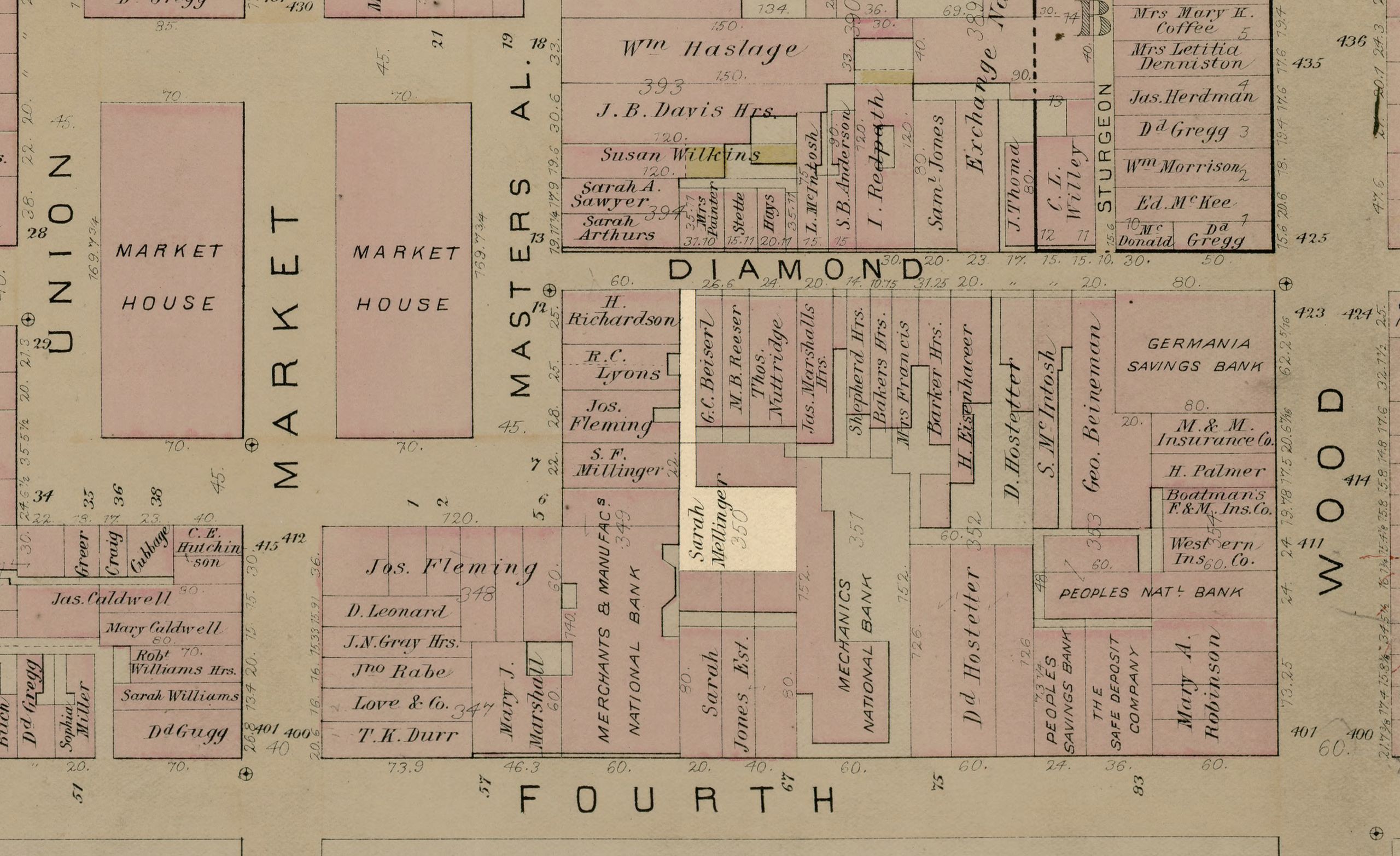
| current | 04:31, 11 April 2023 | | 3,750 × 2,292 (1.88 MB) | Bkell (talk | contribs) | Chicken Alley highlighted in the 1890 Hopkins atlas.{{r|hopkins-1890-vol-1}} ==References== {{references |hopkins-1890-vol-1@4 }} |
You cannot overwrite this file.
File usage
The following page uses this file: