File:1895 Diffenbacher map.png

Original file (8,939 × 6,556 pixels, file size: 1.82 MB, MIME type: image/png)
Summary
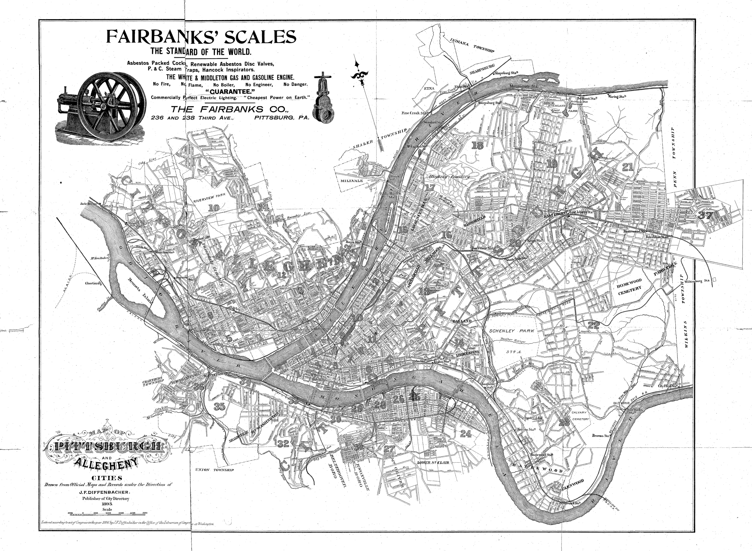
J. F. Diffenbacher. Map of Pittsburgh and Allegheny Cities. 1895. In J. F. Diffenbacher, J. F. Diffenbacher's Directory of Pittsburg and Allegheny Cities for 1895: Embracing a general directory of residences of citizens, full classified business directory, register of public institutions, benevolent societies and city government; directory of the streets, secret societies, schools and churches, fortieth annual issue, J. F. Diffenbacher, Pittsburgh, 1895 (DonsList.net Pgh1895M; Google Books 8ptIwuAxp1wC; Historic Pittsburgh 31735055723278). [view source] diffenbacher-1895-map
File history
Click on a date/time to view the file as it appeared at that time.
| Date/Time | Thumbnail | Dimensions | User | Comment | |
|---|---|---|---|---|---|
| current | 06:07, 11 December 2022 | | 8,939 × 6,556 (1.82 MB) | Bkell (talk | contribs) | {{Source:Diffenbacher-1895-map}} |
You cannot overwrite this file.
File usage
The following 3 pages use this file: