File:1862 Beers map.jpg
From Pittsburgh Streets

Size of this preview: 569 × 600 pixels. Other resolutions: 1,943 × 2,048 pixels | 17,850 × 18,815 pixels.
Original file (17,850 × 18,815 pixels, file size: 90.78 MB, MIME type: image/jpeg)
Summary
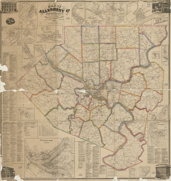
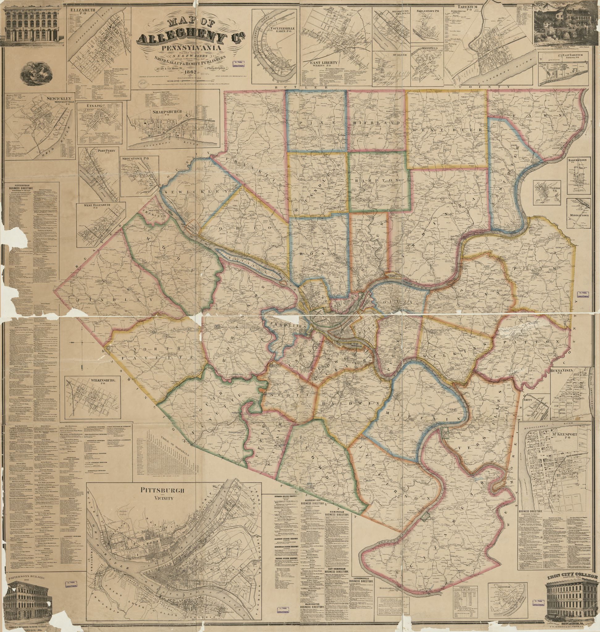
S. N. & F. W. Beers. Map of Allegheny Co., Pennsylvania. Smith, Gallup & Hewitt, Philadelphia, 1862. LCCN 2012592151; https://collections.lib.uwm.edu/digital/collection/agdm/id/31783; 1862 layer at Pittsburgh Historic Maps (https://esriurl.com/pittsburgh). [view source] beers
File history
Click on a date/time to view the file as it appeared at that time.
| Date/Time | Thumbnail | Dimensions | User | Comment | |
|---|---|---|---|---|---|
| current | 22:50, 19 October 2022 | | 17,850 × 18,815 (90.78 MB) | Bkell (talk | contribs) | {{Source:Beers}} |
You cannot overwrite this file.
File usage
The following 3 pages use this file: