File:Stanton Ave. plan.tiff
From Pittsburgh Streets
 Size of this JPG preview of this TIF file: 440 × 599 pixels. Other resolution: 1,503 × 2,048 pixels. |
Original file (3,450 × 4,700 pixels, file size: 122 KB, MIME type: image/tiff, 2 pages)
Summary
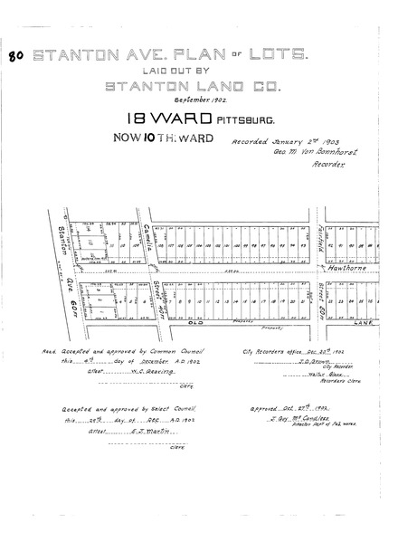
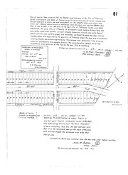
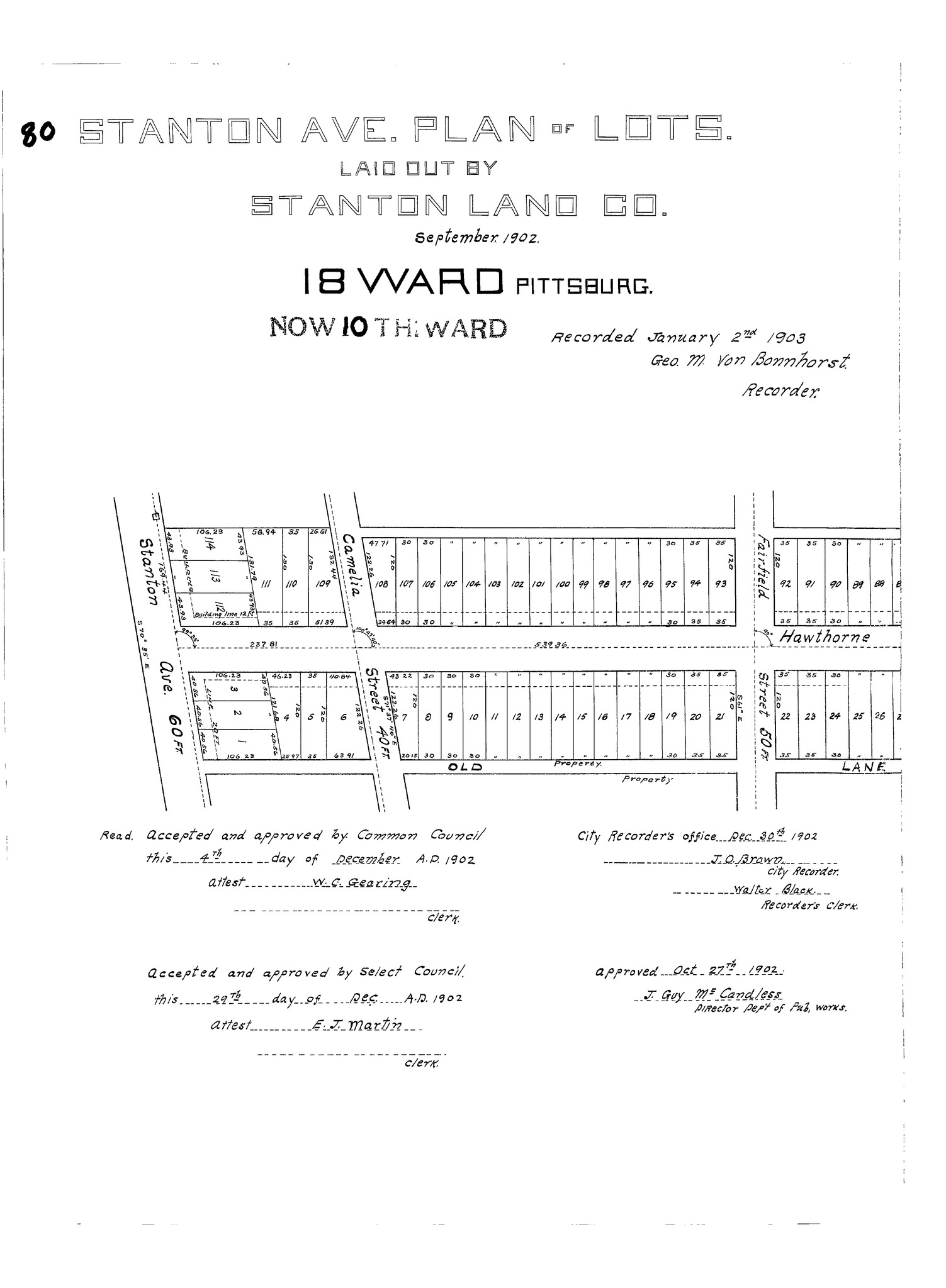
"Stanton Ave. plan of lots: Laid out by Stanton Land Co." Laid out Sept. 1902; recorded Jan. 2, 1903, Plan Book 20, pp. 80–81. Allegheny County Recorder of Deeds 3781968. [view source] stanton-ave-plan
File history
Click on a date/time to view the file as it appeared at that time.
| Date/Time | Thumbnail | Dimensions | User | Comment | |
|---|---|---|---|---|---|
| current | 18:45, 3 February 2024 |  | 3,450 × 4,700, 2 pages (122 KB) | Bkell (talk | contribs) | {{Source:Stanton-ave-plan}} |
You cannot overwrite this file.
File usage
The following 2 pages use this file: